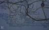
: Map/Figure


Disgrifiadau
Llun: 1
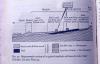
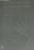
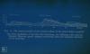
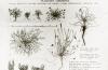
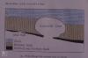
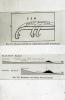
Machair. Profile after Whittow. Geol. + scen mseatd
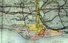
Llun: 2
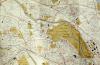
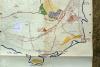
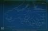
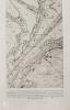
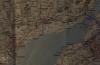
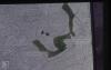
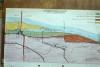
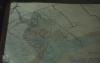
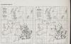
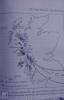
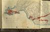
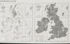
Map. Hebrides, Skye + W mainland
Llun: 3
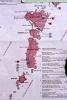
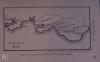
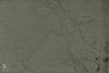
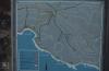
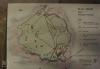
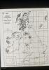
Map. The Uists
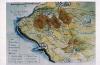
Llun: 4
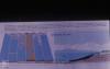
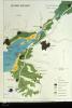
Relief map. Outer Hebrides + Skye.
Llun: 5
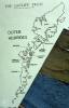
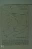
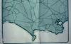
Outline map. Outer Hebrides
Llun: 6
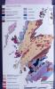
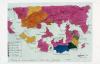
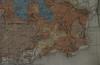
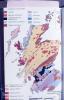
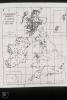
Geology map, Scotland
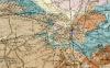
Llun: 7
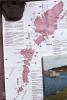
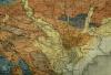
Outer Hebrides map
Llun: 8
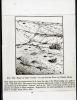
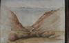
Barra dune and pasture Uist sands
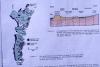
Machair, map and profile after NCC
Llun: 9
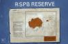
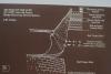
HANDA Island NW Scotland. Sea bird cliffs of N. June 1983
Map of Handa Island bird reserve off Sutherland, 766 acres.
Llun: 10
Blackweir to Western Ave
Map of Taff. Queen Street to Llandaff North
Llun: 11
Physical and chemical factors of R Rhondda and R Cynon
Llun: 12
Substrate flow rate and algae. R Rhondda and R Cynon
Llun: 13
Acidity, O2 and suspended solids in R Rhondda
Llun: 14
Aran Lecture
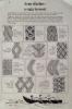
Aran stitches
Llun: 15
Maps. South Border Ridge. Llantrissant to Draethen
Map of coast of Vale of Glamorgan, Port Talbot, Barry
Llun: 16
Vale of Glamorgan. Maps/Geology
Soil map of the Vale of Glamorgan
Llun: 17
Vale of Glamorgan. Maps/Geology
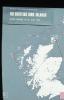
Map. National Parks of Wales and Areas of Outstanding Beauty
Llun: 18
Lavernock locality
Map. Lavernock, Cosmeston, Reserve only. West
Llun: 19
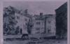
Llantrithydd Place
Old drawing of Llantrithydd Place from M. Robins' thesis
Llun: 20
Maps River Taff
Map of upper taff Vale
Llun: 21
Maps River Taff
Map of lower Taff Vale
Llun: 22
Maps River Taff
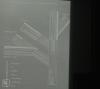
Diagram of Taff river system
Llun: 23
Maps River Taff
Map of Upper Boat, Nantgarw, Graig yr Allt
Llun: 24
Maps River Taff
Taff Vale project Rubbish clearance August 1971. Willowford, gedrys
Dyddiad: 1971
Llun: 25
Taff Maps diagrams
Fish distribution in River Taff system
Llun: 26
Taff Maps diagrams
Map possible salmonoid spawning grounds River Taff 1983
Dyddiad: 1983
Llun: 27
Taff Maps diagrams
Sewin size in River Taff most are around one foot long 1983
Dyddiad: 1983
Llun: 28
Taff Maps diagrams
Invertebrate animals in Taff river system
Llun: 29
Geographical sections through coalfield
Geological section - Merthyr, Rhondda, Vale (and Beacons) Taff Fechan north limestone outcrop
Llun: 30
Geographical sections through coalfield
Geological section through North scarp Brecon Beacons
Llun: 31
Geographical sections through coalfield
Geology. Terminal recessional moraines in South Wales
Llun: 32
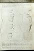
Coal formation diagrams
Types of coal mined in South Wales
Llun: 33
Coal formation diagrams
Formation of coal growth and subsidence of swamp forests
Llun: 34
Coal formation diagrams
Diagram. Formation of coal measures in seams
Llun: 35
Coal formation diagrams
3 mining methods. Opencast, horizintal and vertical shafts
Llun: 36
Coal formation diagrams
Pteridophytes. Diagram of relationships of groups
Llun: 37
Calamites
Calamites. Reconstruction of giant horestail
Llun: 38
Stigmaria, Lepidodendron, Sigillaria
Horestails. Diagram of relationship with calamites
Llun: 39
Stigmaria, Lepidodendron, Sigillaria
Lepidodendron and sigillaria. Reconstruction
Llun: 40
Stigmaria, Lepidodendron, Sigillaria
Cone of lepidostrobus (similar to selaginella)
Llun: 41
Llanwonno Parsleyfern, St Gwynno's Church
Cryptogramma, Northwest Adiantum Southwest Anagrama
Llun: 42
Lower Cynon Valley. Abercynon to Phurnacite plant
1873 map of Abercynon - then navigation
Llun: 43
Lower Cynon Valley. Abercynon to Phurnacite plant
Acidity, Oxygen, Suspended solids in River Cynon
Llun: 44
Llyn Fach, Fossil trees and drowned hut circle
Isoetes habit and spores
Llun: 45
Coalfield ferns and co. Llanwonno, Rhondda
T.S. tree trunk diagram with dates (850 years)
Llun: 46
Severn. Geology
Map of Wentloog Levels, Cardiff-Newport
Llun: 47
Bird, toad, slow worm, frog spawn
Blackbird/Elderberry sketch. 'Countryman'
Llun: 48
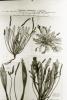
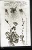
Mercury, spurge
Morphological variation in Plantago coronopus var maritima
Enw rhywogaeth Mary: Plantago coronopus var maritima
Enw gwyddonol: Plantago coronopus
Enw cyffredin: Buck's-horn Plantain
Llun: 49
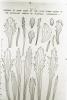
Mercury, spurge
Plantago coronopus var maritima leaf variation, Grassholm
Enw rhywogaeth Mary: Plantago coronopus var maritima
Enw gwyddonol: Plantago coronopus
Enw cyffredin: Buck's-horn Plantain
Llun: 50
Plantains, Polygonum
Plantago coronopus, variation, Skokholm.
Enw rhywogaeth Mary: Plantago coronopus
Enw gwyddonol: Plantago coronopus
Enw cyffredin: Buck's-Horn Plantain
Llun: 51
Primula, Gentian
Samolus valerandi
Llun: 52
Mouth of River Thaw, 1622 field system. Manor of Funmun. (Marg. Davies, Transactions of Cardiff Naturalists Society)
Llun: 53
Map of Aberthaw. One inch OS before power station
Llun: 54
Aberthaw bee orchids
Bee orchid quadrat map, Aberthaw
Llun: 55
INTRO. Habitats and maps
1600 map of Vale of Glamorgan absentee landlords (M Robins PhD thesis)
Llun: 56
INTRO. Habitats and maps
1600 map of Vale of Glamorgan absentee landlords (M Robins PhD thesis)
Llun: 57
INTRO. Habitats and maps
Map of Aberthaw before canalisation of River
Llun: 58
INTRO. Habitats and maps
Aberthaw, map of estuary. 1950s
Llun: 59
INTRO. Habitats and maps
Geology map, mouth of Thaw. Deposits.
Llun: 60
INTRO. Habitats and maps
Surface geology of Cowbridge
Llun: 61
Cwm Bach Stream
1600 map of Ogmore - Dunraven from M Robin's thesis
Llun: 62
South Wales geology. Block diagram
Llun: 63
Draethen. Cwm Leyshon woodland reserve
Coed Cefn Pwll Ddu and Cwn Lleyshon map
Llun: 64
Little Garth Maps. Taff Gorge geology
Map. Little Garth, Tongwynlais, Radyr
Llun: 65
Little Garth Maps. Taff Gorge geology
Proposed SSSI boundary. Little Garth beechwood, October 1972
Llun: 66
Little Garth Maps. Taff Gorge geology
Map of beech as a native (from Hyde 1961, Welsh Timber Trees, Cardiff)
Llun: 67
Flatholm 1st rejects
Flatholm map. Paths and buildings
Llun: 68
River Rumney MAPS
Vegetation map. Saltmarsh outside Rumney at wharf. November 1978
Dyddiad: November 1978
Llun: 69
River Rumney MAPS
Map of Severn Estuary. Land below 50 ft.
Llun: 70
Lamby new lake, 2002
Map, Rumney mouth after cutting of 3rd loop by A48 in 1978
Dyddiad: 1978
Llun: 71
Lamby new lake, 2002
Map, River Rumney in 1950-60s, when no loops cut off.
Dyddiad: 1950-1960
Llun: 72
Maps
Little Garth cave. Finds of flint and bone objects
Llun: 73
Maps
Little Garth cave. Finds of Bronze Age pottery
Llun: 74
Melingriffith feeder and pump. Renovation. 1983
Processes in steel and tin plate workks. Melingriffith
Llun: 75
Map of M4 and canal nature reserve. Tongwynlais. 1983
Dyddiad: 1983
Llun: 76
Tongwynlais reserve in the making. 1976. M4 Reserve
Tongwynlais Canal. Landscape drawing of new reserve between two roads.
Dyddiad: Summer 1974
Llun: 77
Map of Whitchurch canal reserve and Long Wood
Llun: 78
Canal Excavations. Sewer Access Road and Motorway.
Whitchurch Canal. Embankment of M4 and Forest Farm. Access to factories. Plan. 1974
Llun: 79
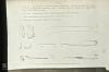
Arrowhead
Sagittaria and Butomis S.E. distribution
Llun: 80
Ailsa Craig, Sula Sgeir
Map of Scotland and Isles, 'Devonia', 1966
Dyddiad: 1966
Llun: 81
Bamburgh, N'umbs and Saltings sunsets
Map Northumbs Farnes - St Abbs
Llun: 82
Lindisfarne Priory
Map of Berwick, Farnes, St Abbs Head
Llun: 83
East Lulworth cliffs and flowers, people and rocks
Map. Geology of Lulworth Cove
Llun: 84
Kimmeridge Bay just before deepening of oil well in 1980
Map of Kimmeridge area, Dorset Heritage Coast
Llun: 85
Abbotsbury Tithe Barn and Pond, 1980
The Fleet. Written description.
Llun: 86
Outline map of Dorset Coast
Llun: 87
Camm system Chesil, Can gully.
Llun: 88
Inward movement of beaches to land
Llun: 89
Dyke swarm radiating from Mull and Skye, Scotland
Llun: 90
Flatholm map. Prinicpal features.
Llun: 91
Carboniferous Minerals
Map of carboniferous limestone and caboniferous and lias quarries, Glamorgan
Llun: 92
Views from Penarth Head and over Cardiff Bay
Geology. Map, Barry, Penarth, Wenvoe
Llun: 93
Geology map of Cardiff
Llun: 94
Rhaetic fossils and pyrites. Westbury on Severn
Geological section, AUST cliff - as seen from M4 bridge
Llun: 95
St Donats Castle, West wood flowers and fish ponds
1776 engraving of Stradling Tower, St Donats from the St Donats History. 1983
Llun: 96
Cwm Nash tufa infill, Monknash
Monknash Valley, 26/09/1876
Llun: 97
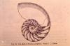
Nautilus pompileus. Section of spiral shell
Enw rhywogaeth Mary: Nautilus pompileus
Llun: 98
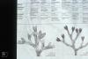
Seaweeds
Diagram. Fucus serratus, ceranoides and table of Fucus characters
Enw rhywogaeth Mary: Fucus serratus
Enw gwyddonol: Fucus serratus
Enw cyffredin: Serrated Wrack
Llun: 99
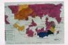
Geology map. Scotland
Llun: 100
Llyn Fach, Rhondda
Drawing of coal forest. Sigillaria, Calamites, etc
Llun: 101
Llyn Fach, Rhondda
Lobelia dortmanna, north west distribution
Llun: 102
Llyn Fach crags. Rhigos 1972
Three isoetes (quillwort) species. North west distribution
Llun: 103
Llyn Fach crags. Rhigos 1972
Hymenophyllum wilsonii. North west distribution and bracken
Llun: 104
Llyn Fach crags. Rhigos 1972
Lycopodium selago. Increasingly north west distribution

More items with these tags
Related items


Cysylltwch â Ni
I wneud cais i dynnu i lawr neu riportio cynnwys hiliol, sarhaus neu niweidiol mewn unrhyw ffordd arall.

You must be logged in to leave a comment