Lavernock: Map/Figure & Geology
Gellir lawrlwytho cynnwys at ddibenion anfasnachol, megis at ddefnydd personol neu mewn adnoddau addysgol.
At ddibenion masnachol cysylltwch â deiliad yr hawlfraint yn uniongyrchol.
Read more about the Trwydded Archif Greadigol.
Disgrifiadau
Maps. South Border Ridge. Llantrissant to Draethen
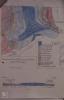
Geological map, Lavernock Point
Ffynhonnell allanol:
Uwchlwytho gan
Dyddiad Ymuno:
19/06/2017
Owner:
South East Wales Biodiversity Records Centre (SEWBReC)
Crëwr:
Dr Mary Gillham
Gwybodaeth drwydded
Copyright Details:
Dr Mary Gillham 2017
Eitem wedi’i llwytho:
27/11/2017
Gwelediadau:
462
Ffefrynnau:
0
More items with these tags
Related items
-
St. Mary Wells Bay, LavernockMath EitemauUwchlwytho gan Llyfrgelloedd Bro Morgannwg -
St Mary's Well Bay, PenarthMath EitemauUwchlwytho gan Llyfrgelloedd Bro Morgannwg -
St Mary's Well Bay, LavernockMath EitemauUwchlwytho gan Llyfrgelloedd Bro Morgannwg -
Porpoise off Penarth - Erthygl o'r Evening Express, 1909Math EitemauUwchlwytho gan Moroedd Byw Cymru -
Tro'r Clogwyni yn edrych tuag at Larnog, PenarthMath EitemauUwchlwytho gan Llyfrgell Genedlaethol Cymru / The National Library of Wales -
Lavernock: History/Archaeology & GeologyMath EitemauUwchlwytho gan 'A Dedicated Naturalist', the Mary Gillham Archive Project -
Lavernock: InvertebrateMath EitemauUwchlwytho gan 'A Dedicated Naturalist', the Mary Gillham Archive Project -
LavernockMath EitemauUwchlwytho gan 'A Dedicated Naturalist', the Mary Gillham Archive Project -
Lavernock: Landscape & WaterMath EitemauUwchlwytho gan 'A Dedicated Naturalist', the Mary Gillham Archive Project -
Lavernock: Geology & Plant/treeMath EitemauUwchlwytho gan 'A Dedicated Naturalist', the Mary Gillham Archive Project
Cysylltwch â Ni
I wneud cais i dynnu i lawr neu riportio cynnwys hiliol, sarhaus neu niweidiol mewn unrhyw ffordd arall.
You must be logged in to leave a comment