Maps of Britain and Wales
Maps of Britain and Wales


Disgrifiadau
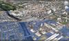
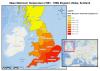
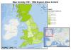
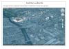
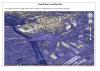
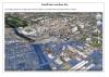
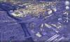
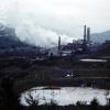
All Maps created to see the difference in the UK and Wales, including the damage of the Phurnacite, and the continuing environmental damage to our country. The map of the UK came from a website called diva gis. The data came from the Met Office. Maps were made using ESRI ArcMap. Credit to Tim Newth for helping create these.
Ffynhonnell allanol:
Cysylltwch â Ni
I wneud cais i dynnu i lawr neu riportio cynnwys hiliol, sarhaus neu niweidiol mewn unrhyw ffordd arall.

You must be logged in to leave a comment